What is Drone Photography? Your Complete Guide to Aerial Imaging
Table of Contents
Drone photography has transformed how businesses capture visual content, offering perspectives that were once only accessible through expensive helicopter hire or fixed camera positions. Understanding this technology for marketing professionals and business owners across Northern Ireland, Ireland, and the UK opens new possibilities for showcasing properties, documenting projects, and creating compelling brand stories.
Whether you’re considering drone photography for your next marketing campaign or exploring how aerial content could strengthen your digital presence, this guide covers everything from the fundamentals to practical implementation strategies that drive results.
Drone Photography Basics
Drone photography represents a significant shift in visual content creation, combining unmanned aircraft technology with high-resolution imaging capabilities. At its core, drone photography captures still images and video footage from aircraft operated remotely or through programmed flight paths using GPS technology.
What Makes Drone Photography Different
The fundamental distinction of drone photography lies in its ability to remove physical constraints from visual storytelling. Where traditional photography positions the camera in the photographer’s hands or on fixed equipment, drones place high-quality cameras anywhere within their operational range, creating opportunities far beyond conventional photography methods.
Modern commercial drones function as sophisticated imaging platforms. They maintain stable hovering positions, execute precise movements, and capture professional-grade footage that once required substantial budgets and complex logistics. This accessibility has democratised aerial content creation, making it viable for small and medium enterprises across various sectors.
How Drones Capture Images
Commercial photography drones, typically classified as UAVs (unmanned aerial vehicles), operate through integrated systems that combine flight control, camera stabilisation, and real-time monitoring. The most common configuration resembles a quadcopter design, using four rotors to achieve stable flight and precise positioning.
The camera system mounts on a gimbal—a pivoting support that counteracts drone movement and vibration. This stabilisation technology is critical for producing sharp, professional images and smooth video footage. Modern gimbals provide three-axis stabilisation, allowing the camera to maintain its orientation regardless of the drone’s movements.
Operators control drones through dedicated remote controllers or mobile applications, viewing live camera feeds while adjusting flight paths and camera angles. Advanced models support autonomous flight modes, automatically following pre-programmed routes or tracking subjects. These features enable complex shots that would be challenging to execute manually.
The Technology Behind Aerial Imaging
Current drone photography technology centres on several key components working in concert. The flight controller acts as the drone’s brain, processing data from multiple sensors, including GPS, gyroscopes, accelerometers, and barometers. This information allows the drone to maintain position, compensate for wind, and execute smooth movements.
Camera technology in photography drones has advanced rapidly. Professional models now feature sensors capable of capturing 20-megapixel still images and video at resolutions up to 5.4K. These cameras often include adjustable apertures, variable ISO settings, and RAW image capture—features previously exclusive to dedicated camera equipment.
Battery technology determines flight duration, with most commercial drones offering 20-30 minutes of flight time per charge. Professional operators carry multiple battery sets to accommodate extended shoots. Intelligent battery management systems monitor cell health and provide accurate remaining flight time estimates, which are critical for safe operations.
Transmission systems link the drone to its operator, streaming live video feeds and telemetry data. Modern systems automatically switch on multiple frequencies to avoid interference and maintain connection quality. This reliability proves essential when operating drones for commercial photography work.
Equipment and Technology for Drone Photography
Selecting appropriate equipment forms the foundation of successful drone photography operations. The market offers numerous options across different price points, each suited to specific applications and skill levels.
Choosing the Right Drone for Your Needs
The optimal drone for photography depends on several factors: intended use, budget constraints, required image quality, and operational environment. For business applications, reliability and image quality typically outweigh recreational features.
Entry-level photography drones provide an accessible starting point for businesses exploring aerial content. Models like the DJI Mini series offer compact designs, simplified controls, and capable cameras that capture 12-megapixel photos and 2.7K video. These drones suit property photography, basic site documentation, and social media content creation. Their sub-250g weight classification simplifies UK regulatory requirements, though professional operation still demands proper certification.
Mid-range options deliver enhanced image quality and professional features. The DJI Air series exemplifies this category, featuring larger sensors, 4K video at higher frame rates, and advanced flight modes. These drones handle most commercial applications, from property marketing to construction progress documentation. Their balance of capability and portability makes them popular choices for professional content creators.
Professional-grade drones target demanding commercial work. The DJI Mavic 3 and Inspire models feature interchangeable lenses, superior sensors, and robust build quality. These systems capture 20-megapixel stills and 5.4K video with exceptional dynamic range and colour accuracy. Professional drones include redundant systems for enhanced safety and advanced obstacle avoidance technology operating simultaneously in multiple directions.
Specialist applications may require purpose-built solutions. FPV (first-person view) drones excel at creating dynamic, immersive footage through built-in structures or tight spaces. Thermal imaging drones serve building surveys and infrastructure inspections. Heavy-lift platforms accommodate cinema cameras for high-end production work.
Camera Specifications That Matter
Understanding camera specifications helps businesses evaluate whether drone imagery meets quality standards. Several factors influence final image quality beyond simple megapixel counts.
Sensor size directly impacts image quality, particularly in challenging lighting conditions. Larger sensors capture more light, producing cleaner images with better dynamic range. A 1-inch sensor significantly outperforms the 1/2.3-inch sensors found in basic drones, especially when photographing during overcast conditions or at dawn and dusk—prime times for attractive architectural photography.
Lens quality affects sharpness, distortion, and overall image character. Fixed focal length lenses typically offer superior optical quality compared to zoom lenses, though zoom capability provides compositional flexibility. Most photography drones feature wide-angle lenses (24mm equivalent), which are ideal for landscapes and architecture. Some professional models offer telephoto options that are useful for detailed inspections and wildlife photography.
Video capabilities have become increasingly important as businesses recognise the engagement power of moving imagery. Frame rates determine motion smoothness, with 30fps suitable for most applications and 60fps enabling smooth slow-motion effects. Bit rate affects video quality—higher bit rates preserve more detail and colour information, which is crucial when footage requires colour grading or extensive post-production.
Recording formats matter for professional work. RAW photo capture provides maximum flexibility in post-processing, allowing photographers to adjust exposure, white balance, and colour without quality loss. Similarly, video codecs like H.265 offer superior compression efficiency, maintaining quality whilst reducing file sizes.
Essential Accessories and Support Equipment
Professional drone operations require more than just the aircraft and camera. Supporting equipment enhances safety, extends operational capabilities, and protects your investment.
Battery management is a critical operational consideration. Multiple battery sets allow extended shooting sessions, while intelligent charging hubs streamline the charging process. Professional operators often carry at least four batteries, providing roughly 90 minutes of total flight time, accounting for battery swaps and safety margins.
Memory card selection impacts both performance and reliability. High-speed cards prevent recording interruptions when shooting high-resolution video. Professional operators use multiple smaller cards rather than large-capacity cards, limiting data loss if a card fails. Regular card maintenance, including formatting and error checking, prevents file corruption.
Protective cases safeguard equipment during transport. Complex cases with custom foam inserts protect against impacts, whilst weatherproof construction guards against moisture. Many photographers opt for backpack-style cases that distribute weight comfortably and allow rapid deployment.
Landing pads provide clean takeoff and landing surfaces, preventing debris from entering motors and protecting camera lenses. Foldable designs pack compactly yet provide adequate landing areas. High-visibility colours aid visual line of sight maintenance during flight operations.
Screen hoods improve mobile device visibility in bright sunlight, which is essential for maintaining proper exposure control and focus during flight. Range extenders boost signal strength for operations in areas with interference or when flying at greater distances.
ND (neutral density) filters control light entering the camera sensor, allowing proper exposure in bright conditions whilst maintaining optimal shutter speeds for smooth video. Professional drone pilots carry sets of ND filters in varying strengths to accommodate different lighting conditions.
Business Applications of Drone Photography
Drone photography delivers tangible value across numerous business sectors. Understanding practical applications helps organisations identify opportunities where aerial imaging can strengthen their marketing efforts, improve operational efficiency, or generate new revenue streams.
Property and Real Estate Marketing
The property sector has embraced drone photography as standard practice for listings above specific price points. Aerial imagery accomplishes several marketing objectives that ground-level photography cannot match.
Aerial perspectives showcase property context—proximity to amenities, transport links, schools, and green spaces. Buyers increasingly make initial decisions based on location factors, and drone footage communicates these attributes more effectively than maps or written descriptions. A property’s relationship with its surroundings is as necessary as the building itself.
For larger properties, country estates, and commercial premises, aerial photography captures scale and grounds that multiple ground-level photos cannot convey cohesively. Sweeping shots reveal garden layouts, parking facilities, outbuildings, and boundaries in single compositions. This comprehensive visual information reduces buyer uncertainty and qualifies leads more effectively.
Development sites benefit from drone photography throughout the sales cycle. Initial aerial surveys document site conditions and context. During construction, regular aerial documentation tracks progress for marketing purposes and creates content for social media engagement. Upon completion, aerial footage showcases the finished development within its community context.
Virtual tours incorporating aerial footage provide immersive experiences that increase engagement with property listings. These tours guide potential buyers through properties and grounds along logical paths, creating narrative sequences that static photos cannot achieve.
At ProfileTree, our property clients report that listings featuring professional drone photography receive 68% more inquiries than comparable properties marketed with ground-level imagery alone. This increased engagement translates directly to faster sales and improved negotiating positions.
Construction Documentation and Progress Tracking
Construction firms face ongoing challenges documenting site progress, communicating with stakeholders, and managing safety. Drone photography addresses these challenges whilst delivering additional benefits.
Regular aerial surveys create comprehensive visual records of construction progress. Weekly or monthly flights capture site conditions from consistent angles, enabling direct comparison between periods. This documentation serves multiple purposes: client reporting, dispute resolution, insurance claims, and marketing content showcasing capabilities to future clients.
Site logistics benefit from an aerial perspective. Drone imagery reveals traffic patterns, material storage organisation, and equipment positioning. Project managers identify bottlenecks, safety concerns, and opportunities for improved efficiency that may not be apparent from ground level.
Safety inspections extend to areas that are difficult or dangerous to access. Drones photograph roofing work, scaffolding installations, and high structures without exposing personnel to hazards. This approach reduces workplace accidents whilst maintaining thorough safety documentation.
When coupled with photogrammetry software, topographic surveys and volumetric calculations derive from drone photography. These measurements track earthworks, calculate stockpile volumes, and verify contractor quantities accurately, rivalling traditional surveying methods at a fraction of the cost.
Marketing departments within construction companies transform project documentation into compelling content. Time-lapse videos compiled from regular drone surveys showcase construction processes, demonstrating expertise and attracting new clients. This dual-purpose approach maximises return on drone photography investments.
“Construction documentation has evolved significantly with drone technology,” notes Ciaran Connolly, Director of ProfileTree. “Projects that previously required expensive helicopter surveys now achieve better results with drone photography at a fraction of the cost, whilst providing content that drives meaningful engagement on digital platforms.”
Event Coverage and Corporate Videos
Events benefit from aerial perspectives that capture atmosphere, scale, and context impossible to achieve with ground-based cameras alone. Drone photography has become expected at premium events, from corporate conferences to festivals.
Drone footage enhances the production value of corporate events. Opening sequences featuring sweeping aerial shots of venues establish context and professionalism. Coverage of outdoor networking sessions, exhibitions, and activities provides unique perspectives that enhance event videos and promotional materials for future editions.
Festival coverage effectively showcases crowds, layouts, and atmosphere. Aerial footage reveals event scale, stage setups, and venue utilisation in ways that ground cameras cannot match. This content is valuable for social media engagement during events and marketing in subsequent years.
Sporting events benefit from aerial tracking shots and establishing imagery, particularly those involving large playing areas or outdoor venues. Drones capture dynamic action from angles that provide viewers a comprehensive understanding of gameplay and tactics.
Promotional videos incorporating drone footage demonstrate production sophistication that distinguishes brands from competitors. The aerial perspective signals investment in quality content creation, positively influencing brand perception. Businesses across sectors—from manufacturing to hospitality—use drone footage to showcase facilities, operations, and locations in ways that create emotional connections with audiences.
Commercial Brand Storytelling and Digital Marketing
Brand differentiation in crowded markets requires distinctive visual content. Drone photography provides perspectives that immediately distinguish marketing materials from standard imagery.
Manufacturing and industrial companies use aerial footage to showcase facility scale, organisation, and operational sophistication. Sweeping shots of production facilities, warehouses, and logistics operations communicate capability and professionalism. This imagery works effectively in corporate presentations, website hero sections, and recruitment materials.
Tourism businesses face intense visual competition. Drone photography showcases destinations from perspectives that inspire travel decisions. Hotels display grounds and locations within attractive contexts. Activity providers demonstrate experiences in ways that written descriptions cannot match. Regional tourism boards use aerial footage to promote areas comprehensively, highlighting landscapes, attractions, and infrastructure.
Retail developments benefit from aerial perspectives communicating accessibility, parking facilities, and tenant mix. Shopping centres use drone footage to update stakeholders on refurbishments and market vacant units to prospective tenants.
Digital marketing campaigns incorporating drone footage achieve higher engagement rates across platforms. Video content receives 1200% more shares than text and images combined, and aerial footage within videos captures attention more effectively than ground-level shots. This performance advantage translates to improved brand awareness and conversion rates.
Social media content featuring distinctive aerial perspectives stands out in crowded feeds. Regular posting of high-quality drone imagery establishes visual consistency that strengthens brand recognition. Businesses developing content libraries of aerial shots maintain flexibility to refresh marketing materials without repeated production costs.
Infrastructure and Industrial Inspection
Technical applications of drone photography extend beyond marketing into operational efficiency and safety improvements. Infrastructure sectors have rapidly adopted drone technology for inspections and surveys.
Telecommunications companies inspect towers, antennas, and cabling without deploying climbing teams. Zoom-light drones photograph equipment details from safe distances, identifying maintenance requirements or damage. This approach reduces inspection costs by approximately 75% compared to traditional methods whilst improving worker safety.
Energy sector applications include wind turbine inspections, solar farm monitoring, and power line surveys. Thermal imaging cameras detect electrical faults, panel defects, and heat loss that visual inspection cannot identify. Regular drone surveys enable predictive maintenance strategies that prevent costly failures and production losses.
Bridge inspections benefit from drone photography’s ability to access undersides and structural components without disrupting traffic or erecting expensive access platforms. High-resolution imagery reveals cracks, corrosion, and structural deterioration that inform maintenance scheduling and budget planning.
Pipeline monitoring across extensive networks becomes practical with drone technology. Aerial surveys identify encroachment, erosion, and potential security concerns along routes requiring substantial ground-based resources to patrol. This surveillance capability provides early warning of issues before they become serious problems or regulatory violations.
Rail infrastructure monitoring includes track condition surveys, vegetation management, and facility inspections. Drones rapidly survey long track sections, identifying drainage issues, ballast conditions, and third-party incursions. This information supports maintenance planning and helps prevent service disruptions.
UK Legal Requirements and Safety Regulations
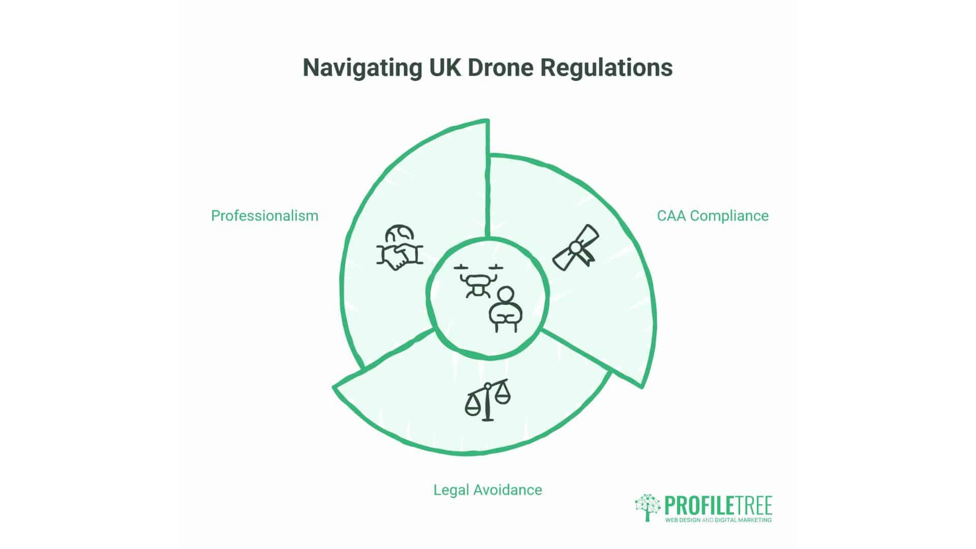
Operating drones for commercial purposes in the UK requires compliance with Civil Aviation Authority (CAA) regulations. Understanding these requirements prevents legal issues and demonstrates professionalism to clients.
CAA Certification and Operator Requirements
Commercial drone operations—any flight where the operator receives payment or the footage is used for business purposes—require specific qualifications and registrations. These requirements apply to businesses operating drones and freelance drone pilots providing services.
Operators must obtain a General Visual Line of Sight Certificate (GVC), the CAA qualification replacing the older Permissions for Commercial Operations (PfCO). This certification requires completing a training course with a CAA-approved National Qualified Entity (NQE), passing a theory examination, and demonstrating practical flying competence.
The GVC qualification covers flight planning, meteorology, air law, and operational procedures specific to commercial drone operations. Successful candidates demonstrate understanding of UK airspace regulations, risk assessment methodologies, and emergency procedures. The certification remains valid for five years, subject to maintaining competency and insurance requirements.
Operator registration with the CAA is mandatory for commercial operations. The Operator ID must be displayed on all drones used for commercial work. This registration connects operators to their aircraft for accountability purposes.
Flyer ID registration certifies that drone pilots understand basic safety requirements. The online test covers fundamental rules and safety procedures. This requirement applies to both recreational and commercial pilots.
Airspace Restrictions and Flight Planning
UK airspace contains numerous restrictions affecting drone operations. Professional operators must identify restrictions relevant to each flight location and obtain necessary permissions before operating.
Flight Restriction Zones (FRZs) surround airports and aerodromes. Without specific permission, most commercial drone operations within these zones are prohibited. FRZ boundaries extend considerable distances from airports, affecting operations across large areas, particularly around major cities.
Controlled airspace classifications (Classes A through G) define where different aircraft types may operate. Drones generally operate in Class G (uncontrolled) airspace below 400 feet. Operations requiring access to controlled airspace need specific authorisation through the CAA’s NATS Drone Assist system.
Temporary restrictions apply for events, royal visits, and emergencies. These Temporary Danger Areas (TDAs) appear with limited notice, requiring pilots to check restriction databases immediately before flights. Drone Assist and similar applications provide up-to-date restriction information.
Privacy considerations affect where operators may legally fly, even within unrestricted airspace. Photographing individuals in private spaces without consent potentially violates privacy laws. Professional operators maintain awareness of privacy regulations and obtain appropriate permissions from landowners and individuals who may appear in footage.
Local bylaws may impose additional restrictions. Some public spaces prohibit drone operations entirely. Operators should verify local regulations through council websites before planning flights in public areas.
Insurance and Liability Considerations
Professional indemnity insurance is mandatory for commercial drone operations in the UK. This insurance protects operators and clients against liability claims from accidents or property damage during drone flights.
Minimum coverage levels vary by operation type and client requirements, though £1 million typically represents the baseline for commercial work. Many clients, huge organisations and public sector bodies, require proof of insurance before permitting drone operations on their property.
Insurance policies specify coverage details, including geographic limits, aircraft types covered, and exclusions. Operators must verify that their insurance covers the planned activities and locations where flights will occur. International operations may require additional coverage.
Equipment insurance protects against loss, theft, or damage to drones and associated equipment. Since professional drone setups frequently exceed £5,000 in value, equipment insurance provides financial protection against significant losses. Some insurers offer combined liability and equipment policies specifically designed for drone operators.
Risk assessments form essential components of professional operations. Comprehensive risk assessments document potential hazards, mitigation measures, and emergency procedures. These assessments protect operators legally and provide frameworks for safe operations. Many insurance policies require risk assessments for claims to remain valid.
Third-party property and individuals pose the most significant liability risks in drone operations. Professional operators maintain safe distances from uninvolved parties, avoid overflying crowds, and select flight paths that minimise risks to people and property below. These precautions reduce accident likelihood and demonstrate reasonable care if incidents occur.
No-Fly Zones and Operational Limitations
Beyond formal airspace restrictions, practical and legal limitations affect where drones may operate and how flights should be conducted.
The 50-metre rule prohibits flying within 50 metres of people, vehicles, buildings, or structures not under the operator’s control. This requirement significantly impacts urban operations and necessitates careful flight planning to maintain compliant separation distances.
Congested area operations require special permissions. Crowded areas are any area within a city, town, or settlement substantially used for residential, industrial, commercial, or recreational purposes. Operations within congested areas necessitate additional permissions and risk mitigation measures beyond standard GVC authorisation.
The proximity of prisons, military installations, and government facilities triggers automatic restrictions. These sensitive locations often have permanent no-fly zones extending several miles from their boundaries. Operations near these facilities require special permissions that may not be granted.
Private property overflight technically remains legal below 400 feet, as property rights extend only to heights necessary for “ordinary use and enjoyment.” However, photographing private property without permission raises privacy concerns and may constitute trespass or harassment depending on the circumstances. Professional operators obtain landowner permissions before operating over private property to avoid disputes.
National parks, Areas of Outstanding Natural Beauty (AONBs), and Sites of Special Scientific Interest (SSSIs) may impose drone restrictions to protect wildlife and visitor experiences. Operators should verify policies with land management organisations before planning flights in these locations.
Getting Started with Drone Photography
Whether businesses intend to develop in-house capabilities or outsource drone photography to professionals, understanding the options and considerations involved enables better decision-making.
In-House vs. Outsourced Drone Photography
Businesses face strategic choices about how to access drone photography capabilities. Depending on circumstances, requirements, and resources, both approaches offer advantages.
Developing in-house drone capabilities suits organisations with ongoing requirements, specialised needs, or security considerations. Construction firms, property developers, and agricultural businesses often find that regular drone usage justifies the investment in equipment and training. Internal capabilities provide scheduling flexibility and eliminate repeated hiring costs.
In-house operations require upfront investments in equipment (£1,000-£15,000 depending on capabilities), training and certification (£1,000-£2,000 per operator), insurance (£500-£2,000 annually), and ongoing maintenance. Staff time for training, certification maintenance, and operations represents additional costs. Equipment depreciation and eventual replacement factor into long-term budgets.
Benefits include immediate availability, operational knowledge of specific sites and requirements, and the ability to capture footage opportunistically as conditions permit. Internal operators develop an intimate understanding of what imagery works for the organisation’s marketing and operational needs.
Outsourcing to professional drone photographers suits businesses with occasional needs, those requiring specialist expertise, or organisations preferring to avoid equipment and training investments. Professional services provide access to high-end equipment, experienced operators, and production expertise without capital expenditure.
Professional drone operators bring several advantages. They maintain current certifications, insurance, and equipment. Their experience producing effective marketing content means fewer flights to achieve desired results. Post-production capabilities, including editing, colour grading, and motion graphics, often form part of complete service packages.
Cost structures for outsourced services typically range from £400-£1,200 per day for experienced operators with professional equipment, varying by location, requirements, and deliverables. Half-day rates and hourly minimums apply for shorter assignments. Additional costs may apply for extensive post-production or specialist requirements like thermal imaging.
Hybrid approaches work for some organisations. Businesses might maintain basic drone capabilities for routine documentation, while engaging specialists for premium marketing content or technical inspections requiring specialist equipment or expertise.
Building Your Drone Photography Skills
For individuals and organisations choosing to develop internal capabilities, systematic skill development ensures efficient progress from basic operations to professional-quality outputs.
Certification training provides a structured introduction to drone operations. CAA-approved courses cover theoretical knowledge, practical flying skills, and regulatory compliance. These courses typically span 3-5 days and include supervised flight hours to build proficiency before practical assessments. Online theory components allow flexible study before intensive practical training.
Self-directed practice after certification develops fluency with controls and camera systems. Empty fields and quiet locations allow practice of basic manoeuvres, such as maintaining stable hovers, executing smooth movements, and coordinating camera control with flight. Proficiency with basic operations must become instinctive before attempting complex shots.
Compositional skills transfer from traditional photography but require adaptation to aerial perspectives. Understanding how subjects appear from above, recognising interesting patterns and relationships visible only from altitude, and anticipating how movement paths will appear on camera require experience. Studying successful drone photography reveals effective techniques and compositional approaches.
Flight planning software and applications streamline professional operations. These tools enable pre-planned autonomous flights, ensuring consistent camera angles for comparison shots and enabling complex movements that manual control cannot replicate reliably. Mastering planning software capabilities significantly improves output consistency.
Post-production skills determine final image quality. RAW photo processing allows correction of exposure variations, colour temperature adjustments, and detail enhancement. Video editing transforms raw footage into compelling stories through pacing, transitions, and soundtrack integration. Colour grading establishes consistent visual styles that strengthen brand identity.
Technical knowledge, including gimbal settings, camera parameters, and flight modes, enables adaptation to varying conditions and requirements. Understanding how shutter speed affects motion blur in video, how ISO settings impact noise levels, or how different flight modes affect battery consumption allows informed decisions that improve results and operational safety.
Tips for Compelling Aerial Perspectives
Creating engaging drone imagery requires more than technical proficiency. Understanding what makes aerial perspectives compelling helps operators consistently produce effective content.
Planning shots before flight conserves battery life and produces better results than improvisation. Scout locations in advance, identifying interesting compositions, optimal sun positions, and potential obstacles. Digital maps and satellite imagery assist planning when physical reconnaissance isn’t practical.
Lighting dramatically affects aerial photography quality. The golden hour—shortly after sunrise or before sunset—provides warm, directional light that adds depth and atmosphere to landscapes and architecture. Midday harsh overhead light often produces flat, unappealing imagery. Overcast conditions provide soft, even illumination ideal for specific subjects, but lack directional light drama.
Height variation creates visual interest in video sequences. Transitioning from low positions up to maximum altitude progressively reveals subjects within their contexts. These “reveals” create engagement by gradually expanding viewers’ understanding of locations.
Movement adds dynamism to drone footage. Simple forward flights, orbital movements around subjects, and parallax effects (where foreground elements move faster than background elements, creating depth perception) transform static scenes into engaging sequences. Smooth, controlled movements appear more professional than erratic or rushed camera work.
Subject selection matters. Not every location benefits from aerial photography. Look for patterns visible from above—rows of crops, architectural layouts, natural formations. Seek relationships between elements that ground-level perspectives cannot reveal. Contrasting subjects and surroundings creates visual impact—a lone tree in a field, buildings amid greenery, or vehicles on empty roads.
Horizon positioning follows traditional compositional guidelines. Placing horizons along rule-of-thirds lines generally creates more pleasing compositions than centred horizons. However, symmetrical subjects may justify centred compositions. These decisions depend on the specific scene and intended emotional impact.
Foreground interest prevents aerial shots from appearing empty or distant. Including elements in the near foreground—trees, buildings, water features—creates depth and provides scale references that help viewers understand spatial relationships.
Working with Professional Drone Operators
Businesses engaging drone photography services achieve the best results through clear communication and understanding of how professional operators work.
Brief operators thoroughly about objectives, target audiences, and how the footage will be used. Different applications require different approaches—property marketing emphasises location context and features, while construction documentation prioritises consistent angles and comprehensive coverage. Clear objectives enable operators to plan appropriate shots and allocate time effectively.
Provide site access information and scheduling flexibility. Drone photography depends heavily on weather conditions and lighting. Professional operators may need to reschedule flights due to wind, rain, or poor light. Building flexibility into schedules accommodates these requirements without compromising deadlines.
Obtain necessary permissions before operator arrival. Property owners, site managers, and relevant authorities should approve drone operations in advance. Professional operators will verify permission, but client-side coordination prevents delays and demonstrates professionalism.
Discuss deliverables explicitly. Specify required formats, resolutions, and editing requirements. Video projects should clarify desired lengths, music licensing responsibilities, and revisions included in quoted fees. Still photography assignments should specify the number of edited images delivered and the RAW file provision if required.
Review portfolios and sample work during operator selection. Previous work demonstrates technical capabilities, creative approaches, and production quality. Operators specialising in your industry bring relevant experience that improves results.
Understand insurance and liability arrangements. Verify that operators carry appropriate public liability insurance and confirm coverage limits meet your requirements. Request insurance certificates and operator credentials before confirming bookings.
Budget appropriately for quality work. Experienced operators with professional equipment and production capabilities command premium fees justified by superior results. The visual content produced forms substantial portions of marketing budgets, and quality differences between amateur and professional work significantly impact return on investment.
Making Drone Photography Work For Your Business
Drone photography represents more than attractive imagery—it’s a strategic marketing and operational tool that delivers measurable returns across numerous business applications. From property marketing to construction documentation, drones’ unique perspectives communicate information and create emotional engagement that conventional photography cannot match.
For businesses across Northern Ireland, Ireland, and the UK, accessibility to professional drone services and improved technology has removed barriers that once limited aerial imaging to large corporations with substantial budgets. Small and medium enterprises now regularly deploy drone photography to compete effectively against larger competitors.
The decision to develop internal capabilities or partner with professional operators depends on usage frequency, budget considerations, and the strategic importance of visual content to your business. Both approaches can deliver excellent results when implemented thoughtfully with clear objectives.
At ProfileTree, we’ve witnessed drone photography transform how businesses present themselves across digital channels. The technology aligns perfectly with current content marketing trends, emphasising visual storytelling and authentic brand presentation. Video content dominates social media engagement, and aerial perspectives provide the distinctive quality that stops scrolling and captures attention.
Beyond marketing applications, operational uses of drone photography deliver efficiency improvements and safety benefits that generate direct cost savings. These dual-purpose applications—where operational documentation becomes marketing content—maximise return on investment.
As regulations stabilise and technology advances, drone photography will become increasingly standard across industries. Businesses adopting these capabilities early establish competitive advantages through superior visual content and operational efficiencies that compound over time.
Whether you’re marketing properties, documenting construction projects, creating brand videos, or exploring technical inspection applications, professional drone photography offers capabilities that improve outcomes and strengthen your market position.